|
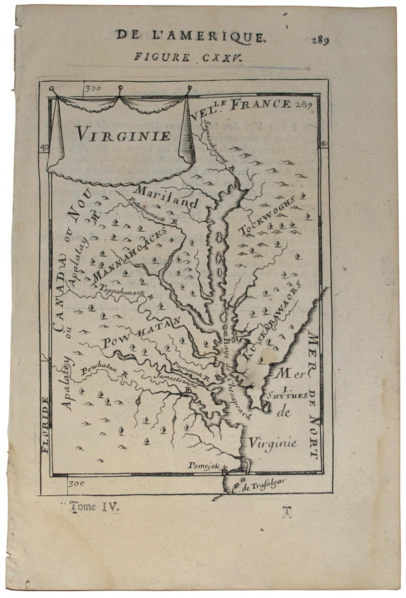
This small and simple
engraving of Virginia was published in 1683 by French
cartographer Alain Manesson Mallet. Mallet
compiled and published Description de L'Universe,
one of the most ambitious and wide-ranging compilations
of the peoples and places of the world. In
addition providing information and engravings of places
on every continent, the 5 volume publication also
contained numerous maps depicting basic cartography of
regions based on knowledge of the day. This
engraving of the Chesapeake Bay region is from Mallet's
first edition, printed in Paris in 1683. Among the
several Native American tribal regions shown is that of
the Powhatans. The map also shows the location of
Jamestown, as well as what appears to be an island named
for Captain John Smith in the Sea of Virginia (Mer de
Virginie). Florida (Floridae) is
printed in the far left margin, Maryland (Mariland)
is shown to the north of the tribal regions, and Canada
(Canada ou Nouvel le France) is printed as the
northernmost and westernmost borders of the region.
While very primitive and Franco-centric in its
execution, the map is a charming 17th century depiction
of one of the earliest settled regions in America.
Its mention of both the Powhatan Indian regions and John
Smith make the map a charming anchor in the Rare Flags
collection between the engravings of Captain John Smith
(see
IAS-00410)
and Pocahontas (see
IAS-00409).
|