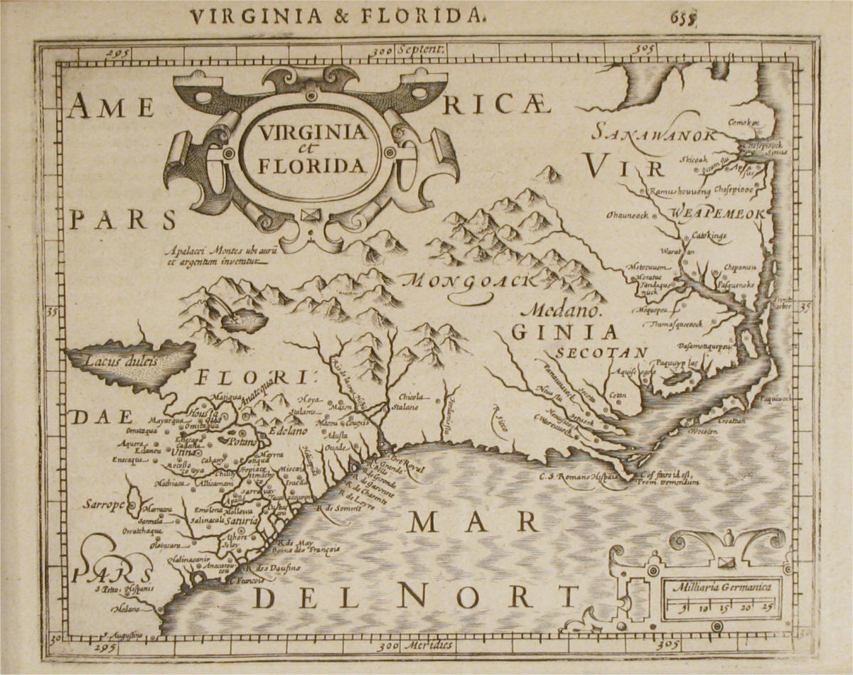
Early maps of the
United States, such as this small map engraved in 1609,
are some of the earliest surviving artifacts of this
period relating to America. It's amazing to think that
at the same time Jodocus Hondius made this map in 1609,
Captain John Smith was actually there on the ground,
leading the Virginia colony at Jamestown (September,
1608 to August, 1609) and exploring this very same part
of the world. The map is an interesting
combination facts and fancy, though generally it
presents a significant amount of recognizable and
accurate details about this portion of the Mid-Atlantic
coast. At the top of the map, we see the
Chesapeake Bay (labeled Chesepiock). The Outer Banks
span from Virginia and what today is the Carolina coast.
The coast follows a more westerly route than in reality,
but the profile is reasonably accurate, especially for
such an early age. Maps such as this were made to
inspire exploration and adventurers, and several inland
features are shown which are intriguing, but which in
reality never existed. For example, a large lake,
Lacus Duleis, is ficticious. The Appalachian
Mountains are depicted, with a label that reads "Apalacci
Montes ubi auril et argentum invenitur", which
translates from the Latin to read "Appalachian Mountains
with gold and silver mines". The tribal regions
for many Native American tribes such the Secotans and
the Weapemeoks, are also named on the map.
Finally, at the far southern edge of the map, we see "S
Augustino", the settlement of St. Augustine, Florida,
founded by the Spanish in 1565 and the oldest
continually occupied European settlement in the
continental United States. |

